The National Earthquake Information Center (NEIC) has estimated that millions of earthquakes take place globally that go undetected or are unreported. This could be due to their occurrence in remote locations or with small magnitudes.
On the other hand, countries like the United States have some of the most frequent landslides in the world, even costing the lives of about 25 - 50 people every year. In fact, this particular natural calamity has been estimated to cause more than 47,000 deaths overall in the last decade or so. Most landslide fatalities are in the form of rock fall, debris-flow or volcanic debris.
But observing the Wenchuan quake that happened in China in 2008, several deaths (approx. 20,000) resulted from the landslides that were triggered by the tremors of the earthquake, and not because of the actual quake.
Predicting Earthquake-Triggered Landslides
In the past, apps have been created for earthquake detection, and systems developed to warn against calamities but, really, have been unable to foretell of forthcoming tremors well-in-advance. Even certain government agencies have attempted to track and alert populations living under “danger zones.”
Looking at this problem from another angle, a group of researchers from Indiana University developed a model that can address risks by calculating the chances of earthquake-caused landslides. This concept can be applied to any location worldwide. The process makes available life-saving information within a few minutes, which can then be relayed to relevant organizations that help people in the vicinity of such natural disasters.
Anna Nowicki Jessee, a research fellow at the IU Bloomington College of Arts and Science, and lead investigator of the study, said, “The ultimate goal of this work is that fast, regional estimates of landslide occurrence would provide a way for those who are affected to receive the aid they need more quickly and efficiently.”
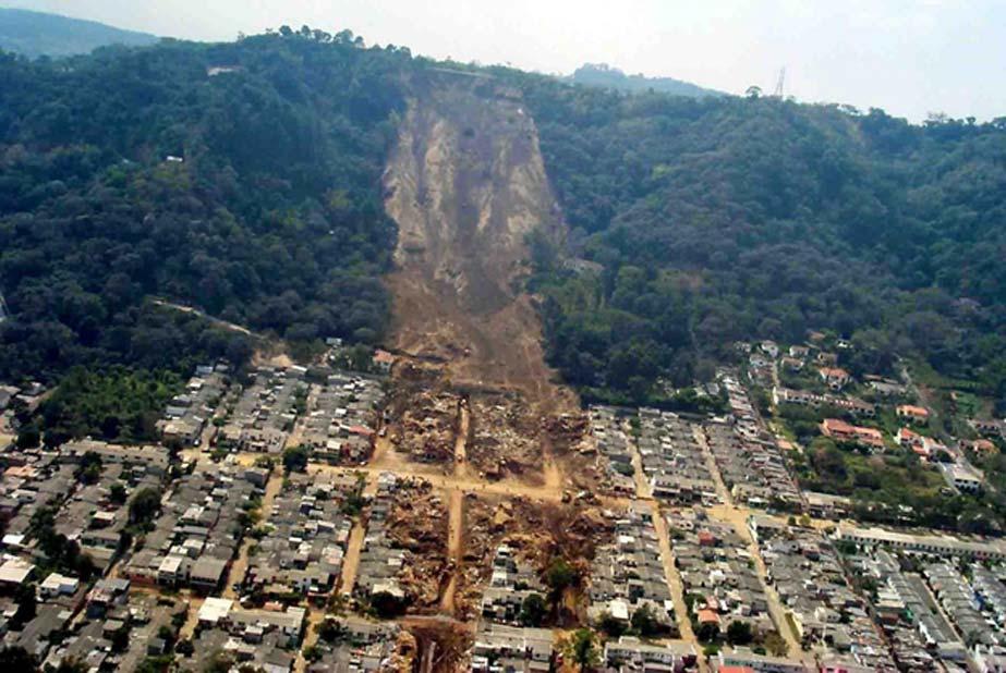
A landslide induced by an earthquake in El Salvador in 2001. (Source: US Geological Survey (USGS))
Researchers, Jessee, Micheal Hamburger and Scott Robeson of IU Bloomington, in collaboration with a team from the U.S. Geological Survey and the University of Twente, Netherlands, published a paper describing this model in the Journal of Geophysical Research: Earth Surface. The research is titled, ‘A Global Empirical Model for Near Real-time Assessment of Seismically Induced Landslides.’
Since this project has high scope in relief work, it will become a ‘Ground Failure' tool as part of the U.S. Geological Survey’s reporting system.
Design & Development of the Model
Twenty-three landslides inventories were used that collected information of earthquakes of various magnitudes, and a range of other factors like tectonic settings.
The project basically indicates a mathematical relationship between landslides and five variables — the amount of ground-shaking, steepness/topographic slope, the lithology, wetness of the ground, and the presence of land cover.
Over 100 combinations were tested in multiple versions, based on past earthquake-induced landslides, and the predictions that best matched the occurrences were chosen using statistical tests.
With this model, scientists can develop a map — using a tool called ShakeMap — which can predict the probability of landslides in the surrounding areas of the quakes. The results will be provided within minutes, for any place in the world, which can then quickly be conveyed to corresponding agencies.
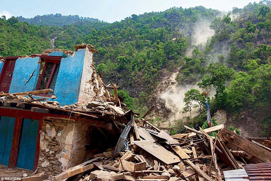
Another example is the twin earthquakes of Nepal in 2015, which triggered landslides, and even flooding, that affected millions of people. (Image Source: Reuters)
In short, as soon as the earthquake occurs, researchers can use the “ground-shaking” information to draw up a map of affected regions. There is a high likelihood that the same region can be subjected to a landslide, and people can be notified of such dangers, beforehand.
Jessee, co-creator of the model, said the best part of the product was the idea of being able to help who are constantly impacted by natural hazards such as landslides, frequently caused by earthquakes.
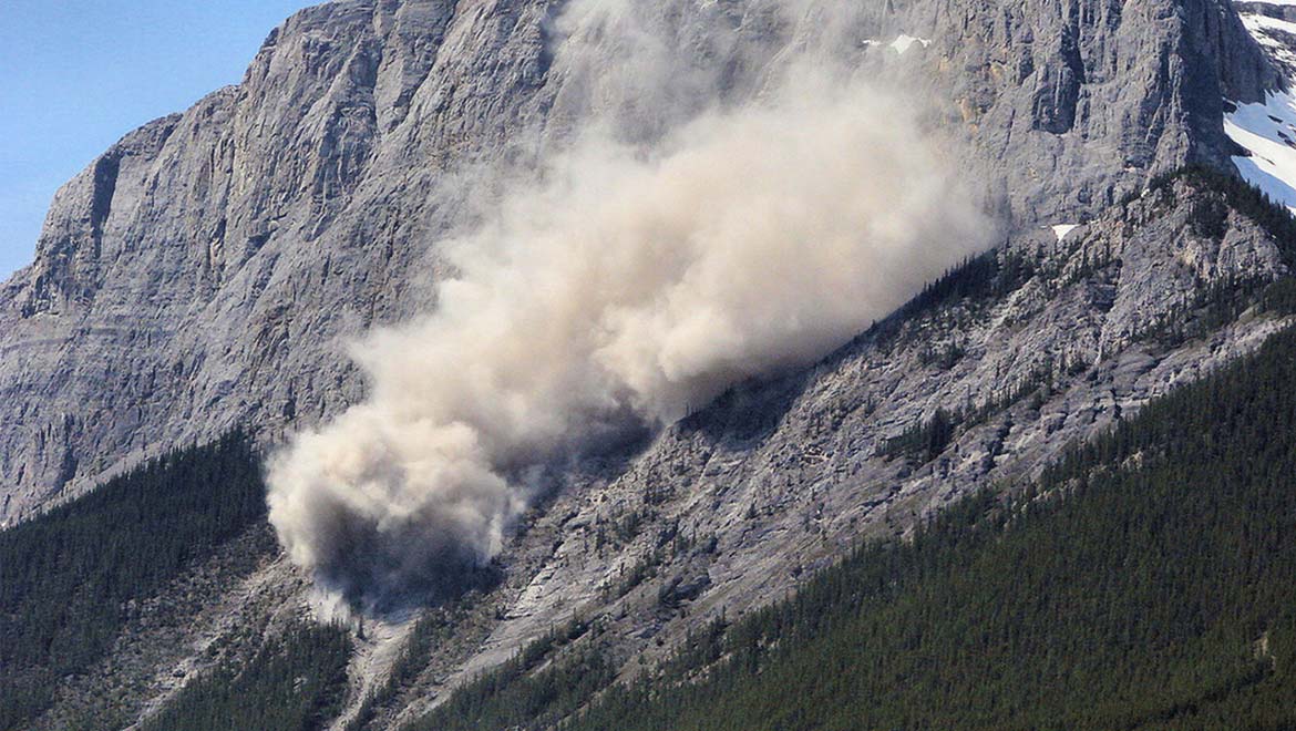
Top Image: Landslide as seen by a tourist outside Banff National Park, Canada. (Source: Sheri Terris @ flickr)
References
Frequency of Earthquakes Worldwide, Infoplease, https://www.infoplease.com/world/earthquakes/frequency-earthquakes-worldwide, (accessed 2 Aug 2018)
How many deaths result from landslides each year? USGS, https://www.usgs.gov/faqs/how-many-deaths-result-landslides-each-year, (accessed 2 Aug Jul 2018)
IU researchers develop model for predicting landslides caused by earthquakes, 2018, EurekAlert, https://www.eurekalert.org/pub_releases/2018-07/iu-ird072418.php, (accessed 5 Aug 2018)
Researchers develop model for predicting landslides caused by earthquakes, 2018, GeoSpace, https://blogs.agu.org/geospace/2018/07/24/researchers-develop-model-for-predicting-landslides-caused-by-earthquakes/, (accessed 5 Aug 2018)
Earthquake-Triggered Landslides Could Soon Be Predicted With New Model, 2018, International Business Times, https://www.ibtimes.com/earthquake-triggered-landslides-could-soon-be-predicted-new-model-2702617, (accessed 5 Aug 2018)


No comment